Elastic Stack
The Elastic Stack is a geospatial powerhouse
Store all of your geospatial data and run queries at top speeds with Elasticsearch. Find anomalies, trigger notifications, and solve location-based problems with Kibana.
Explore, analyze, and discover the where in your data — with geospatial capabilities from the Elastic Stack.
Geospatial analysis without boundaries
As your data volumes grow exponentially, your geospatial data and the ability to analyze it at speed and scale become more and more valuable — from analyzing customer data to asset tracking. Combine the search, aggregation, and speed of Elasticsearch with Kibana’s intuitive visualizations using the Maps app and dashboards. Start with one geo use case and expand to others — it’s easy to scale and grow with the Elastic Stack.
Everything geo is powered by Elasticsearch
Geospatial analysis with speed, at scale. Spatial queries will help you answer location-driven questions. Distance queries will let you understand proximity. All with a stack that scales automatically.
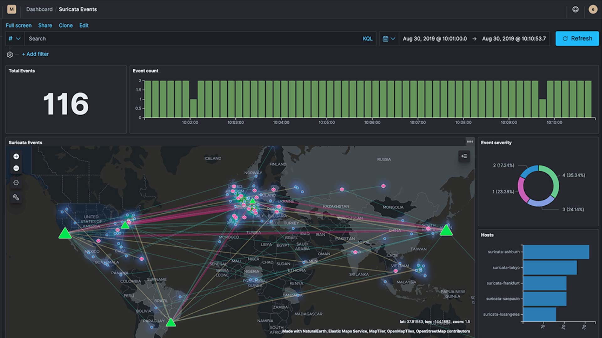
Explore and answer your geodata questions with Kibana
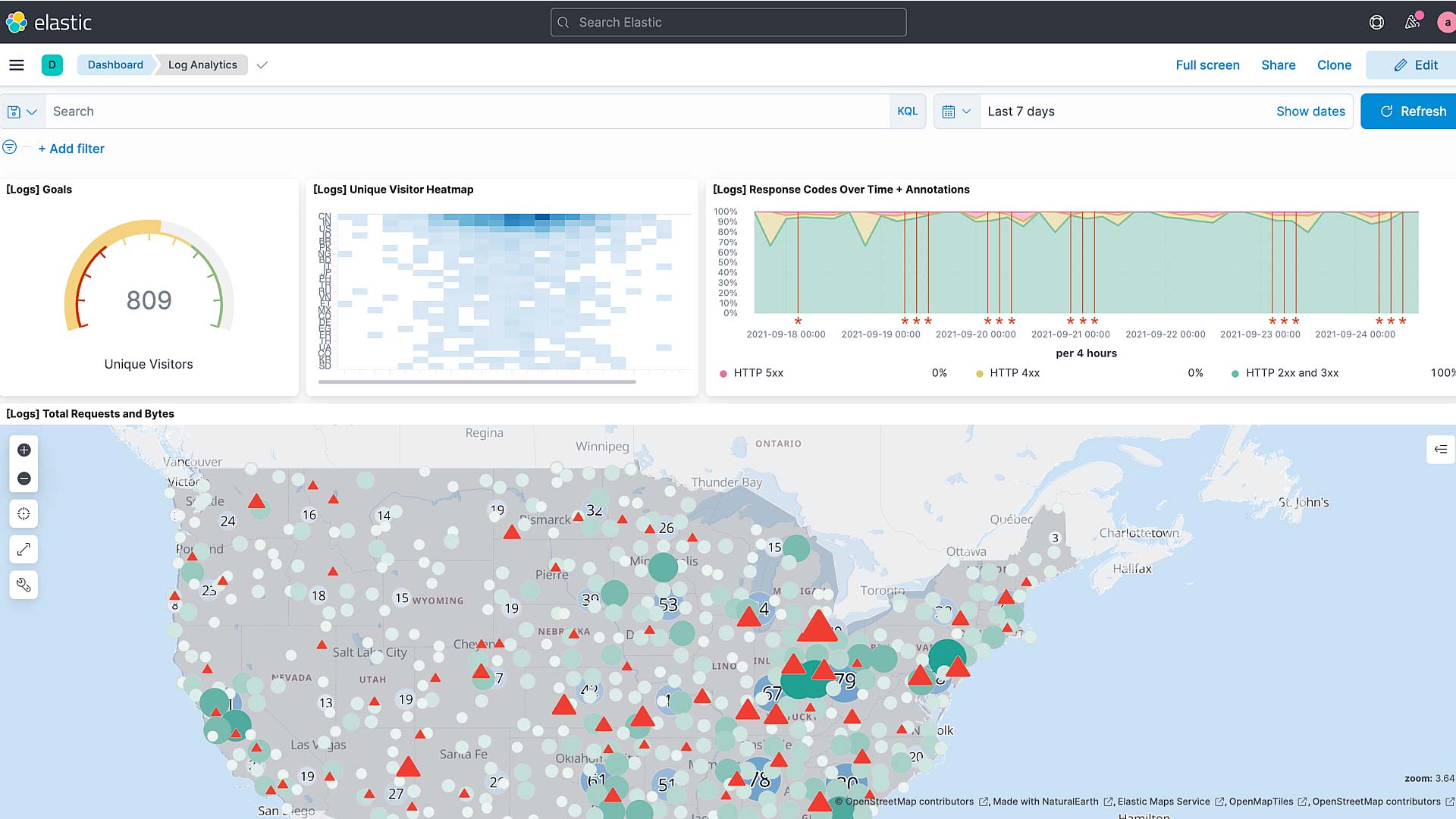
Kibana is the platform for geospatial analysis and action. Use Elastic Maps for analyzing geospatial data and identifying geo patterns over time, points of interest, and other avenues of exploration. Easily share and consume geospatial data via dashboards and set up location-based alerts to make your geospatial data actionable.

Maps and visualizations with ease
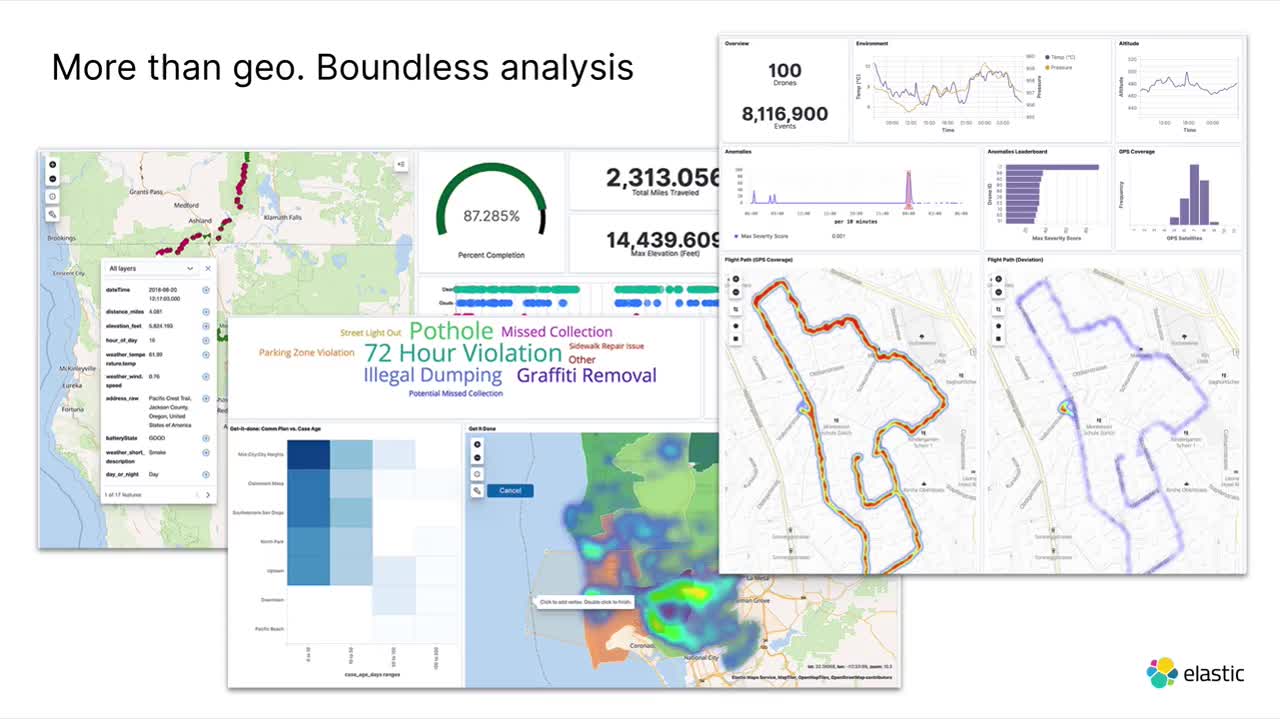
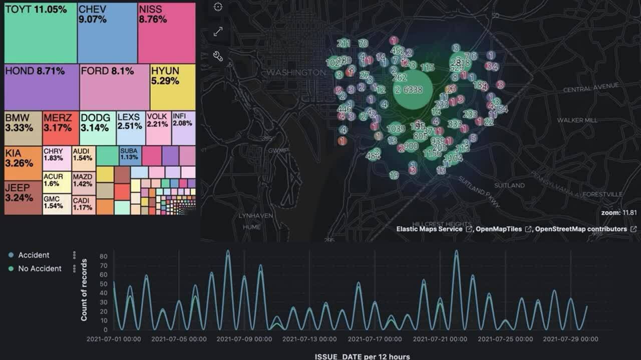
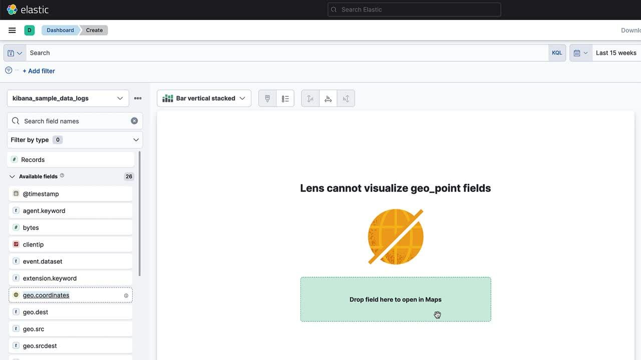
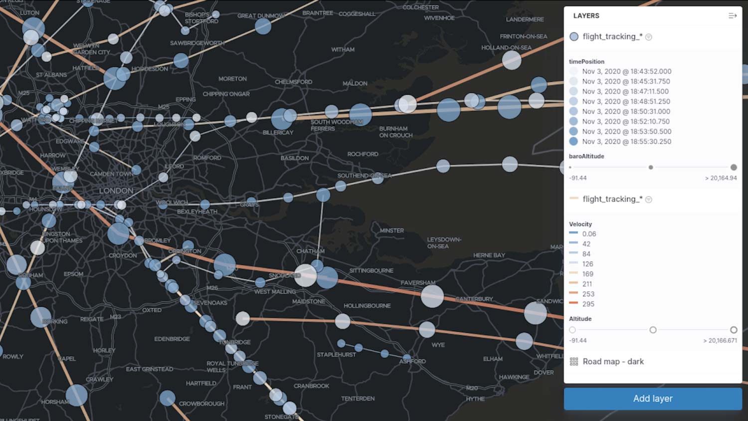
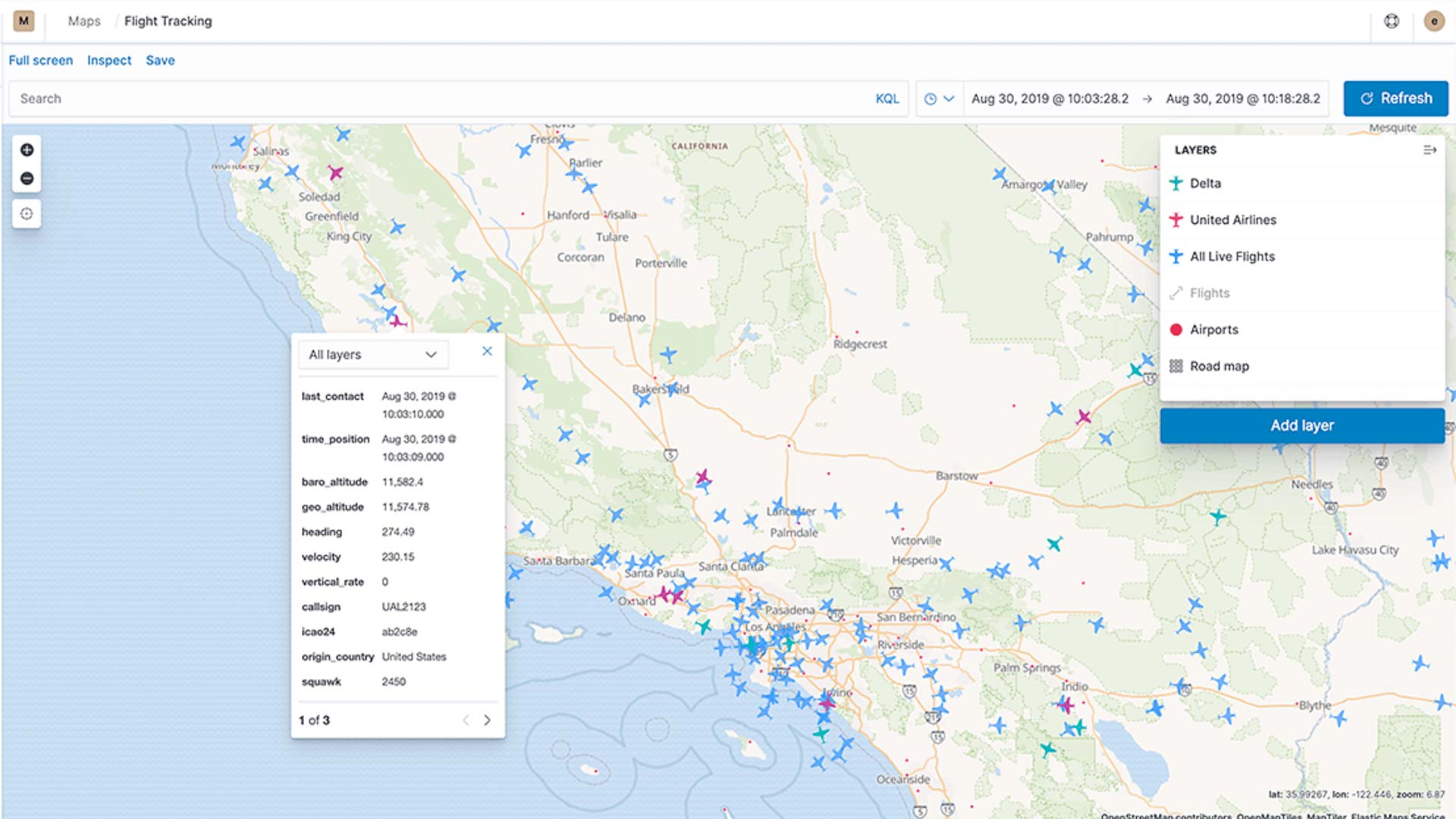
Build geospatial visualizations with ease using the Maps app. It’s simple to visualize data from Elasticsearch or upload your own from a CSV or GeoJSON file. Perform analysis based on the shape and content of the data — use choropleth layers to compare statistics across countries or regions, point-to-point maps to understand origin-destination connections, and dynamic heatmaps, grids, and clusters to instantly see spatial patterns.
Maps made smarter with machine learning
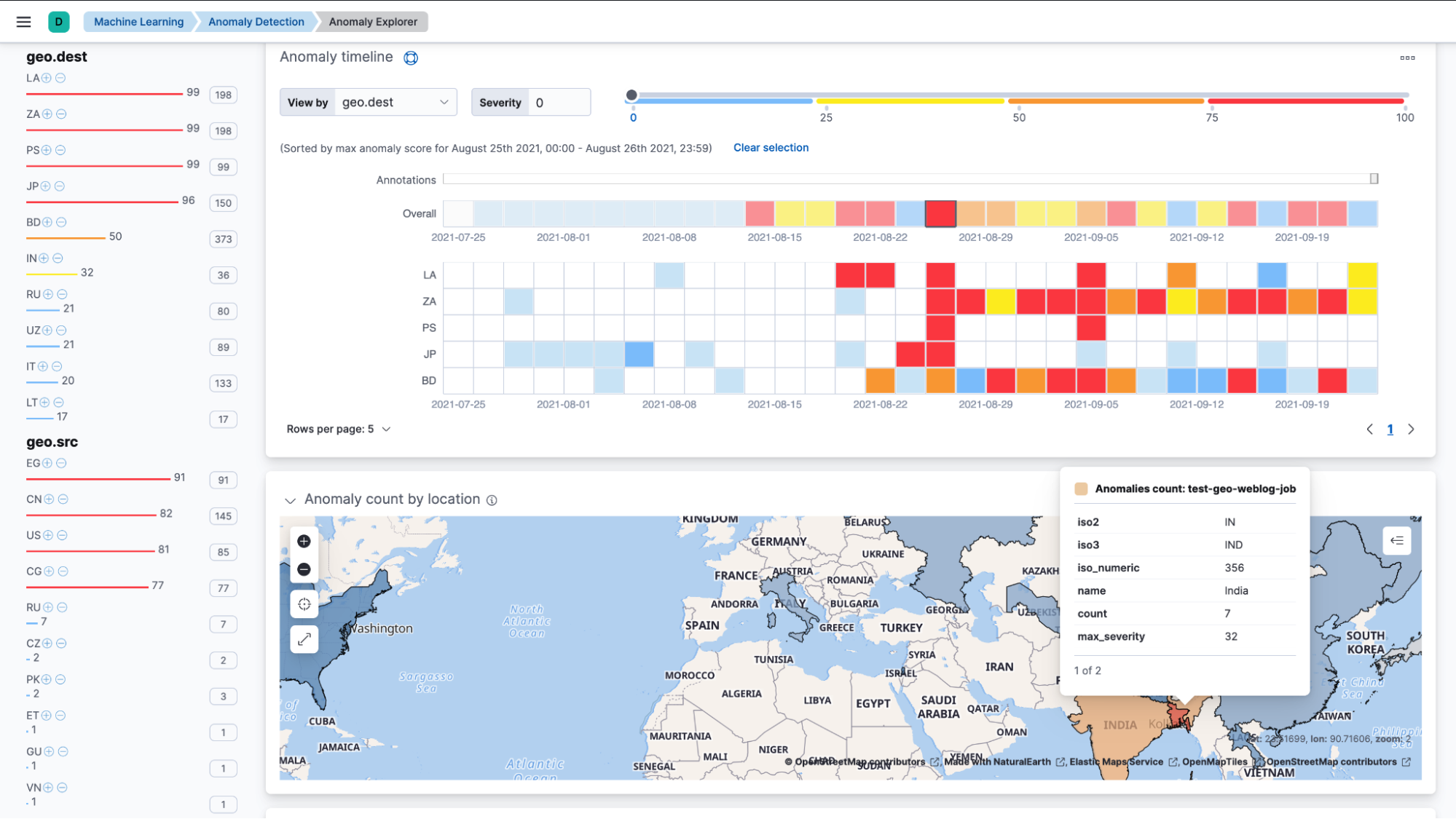
Put machine learning to work for you and find the data that should stand out with anomaly detections. Location-based anomaly detections make it easy to find and explore and compare anomalies with their typical locations.
Driving insights with location data
Let your location data drive insights and action with geographic alerts. Commonly referred to as geo-fencing, track moving objects as they enter or exit a boundary to receive notifications through common business systems (email, Slack, Teams, PagerDuty, and more). Whether your work is in asset tracking for shipping and logistics or monitoring IoT devices in the context of security, geospatial alerts give you information to act on.
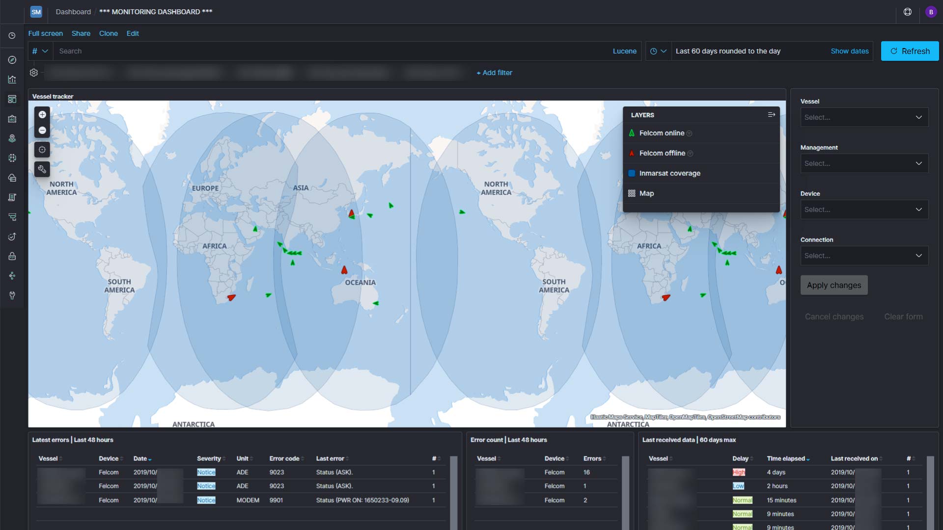
The Nature Conservancy monitors the security of their network across offices and outposts (with limited connectivity) around the globe.
Additional resources
Want to learn more about using the Elastic Stack for geospatial analysis? See exactly what we have to offer.
Videos on demand
See how the Elastic Stack can be used to explore your geo questions.
Training
Dive into the Elastic Stack with our team to learn more about our capabilities.
Quick Start guides
Get started on your own by following along with our documentation guide.