Elastic Maps
無料かつオープンな
位置情報データ探索
Elasticマップを使って、地理空間データを分析しましょう。複数のインデックスを複層レイヤーとして1つのビューに表示し、Elasticsearchデータ全体にわたるクエリや、関連付けを実行できます。
マップに地理データを入れる
Elastic Stackを使う現場にたびたび登場するのが、「どこで?」という問いです。攻撃者からネットワークを保護するときも、特定の地域でアプリのレスポンスが低速化するときも、タクシーで帰宅するときでさえ、地理データの検索が重要な役割を果たします。無料かつオープンなKibanaのマップアプリは直感的な操作性を備えています。変化するデータや構造化データ、テキストなど広範なElasticsearchデータから地理空間レイヤーを生成し、有意義な回答を返します。
米国の自然保護団体、ザ・ネイチャー・コンサーヴァンシーは世界各地のオフィスと、アクセスが不安定な出先機関を結ぶネットワークのセキュリティを監視しています。
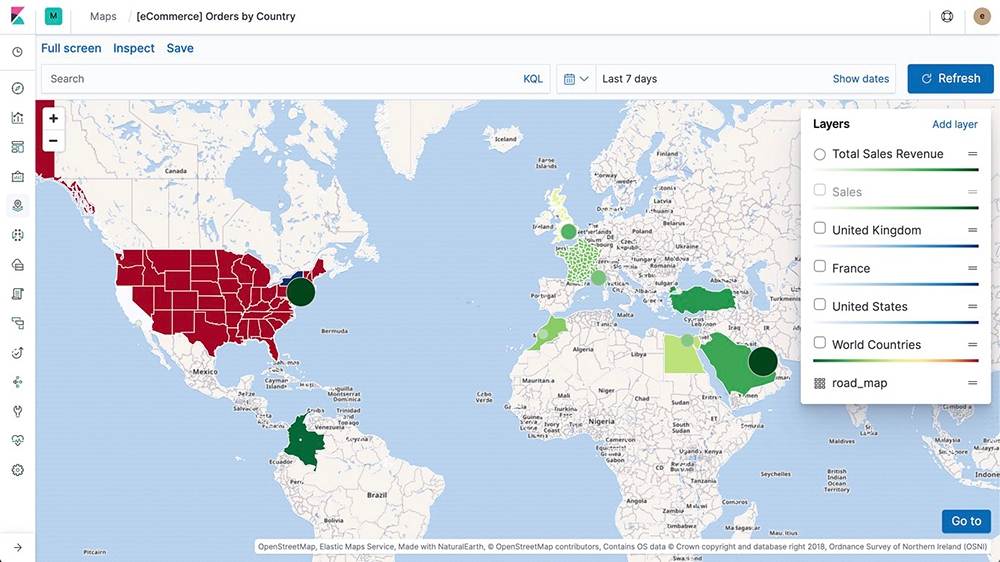
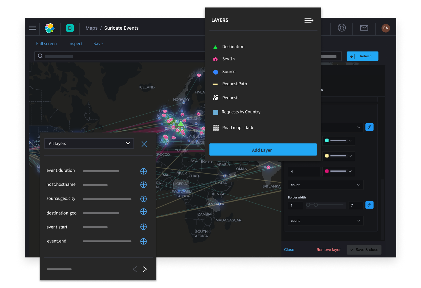
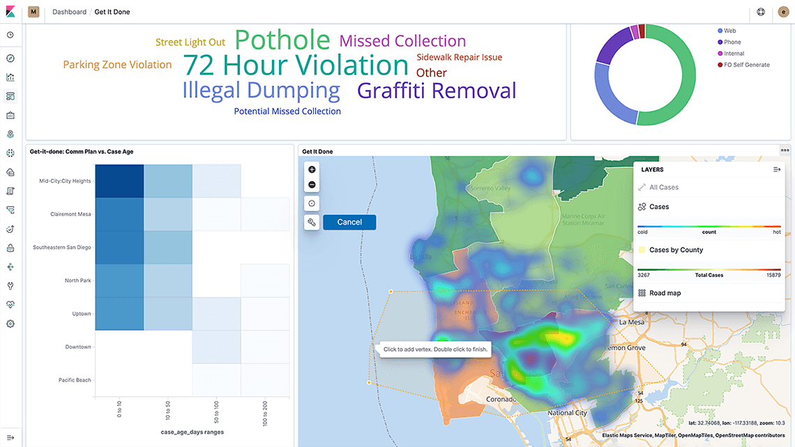
複数のソースから来るデータを1つのマップに表示
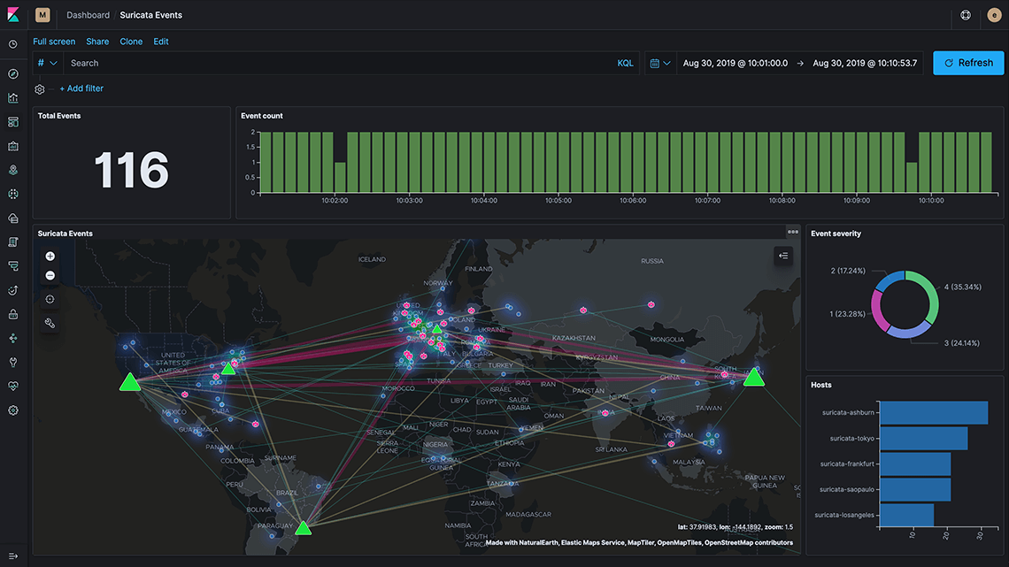
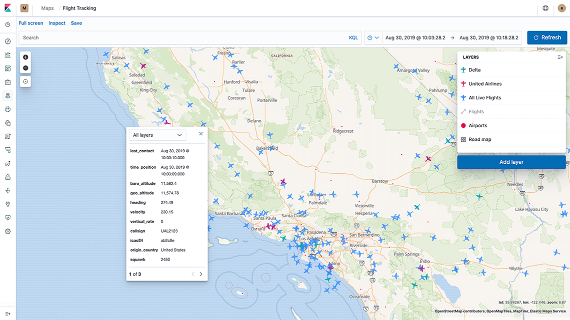
Kibanaのマップアプリは、複数の異なるインデックスを複層レイヤーとして1つのビューに表示します。同一の地図上に多数のインデックスレイヤーを重ねることで、リアルタイムに一括で検索したり、絞り込むことが可能です。セキュリティオペレーションセンターで、静的なサーバーの位置情報と、動的な攻撃位置情報を同時に監視することもできます。気になる情報があればマップを拡大。独立したドキュメントとして高精度なドリルダウンができます。
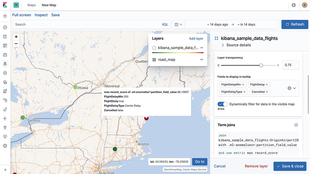
地理+各種データ
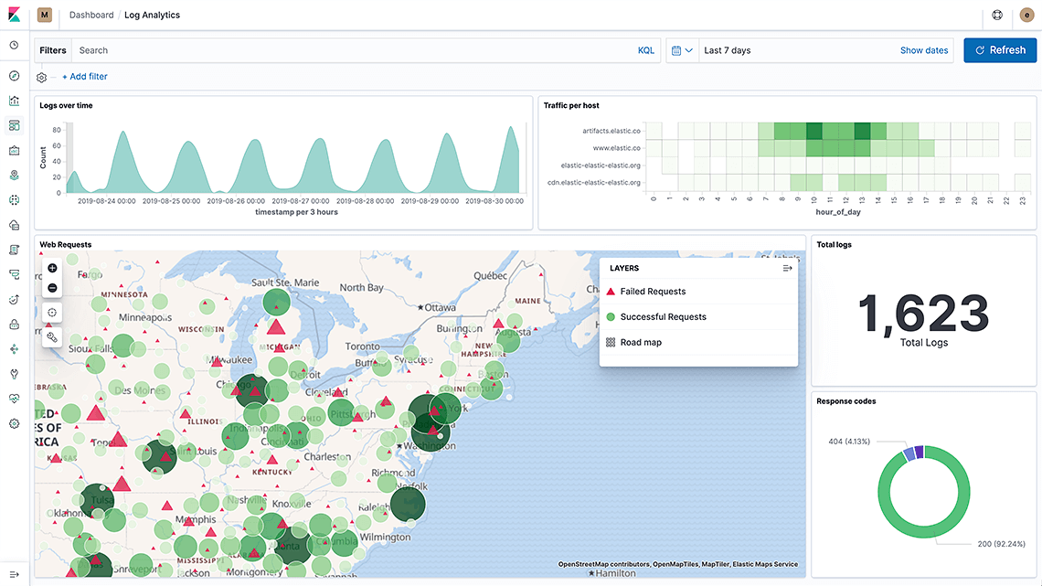
地理空間データは、緯度と経度のデータだけにとどまりません。マップ上のピンは、メトリックやタイムスタンプ、その他のメタデータを含む可能性があります。Elasticsearchはジオポイントから、ポリゴンや円、線、複線、四角といったジオシェイプまであらゆる種類の位置情報データを格納します。全文検索エンジンとして使えるだけでなく、列指向ストアとして、あるいは、あらゆる数的データに対応するメトリックストアとして、地理情報にとどまらない広範な分析を実行できます。
無限の可能性、すばやい回答
速さやスケーラビリティ、関連度、データの動的な可視化といった強みを持つElastic Stackを使えば、地理データにパワフルな分析オプションが加わります。 Kibanaのダッシュボードに直接マップを埋め込み、あらゆるデータと一緒に位置情報データを操作してみましょう。距離での並べ替えや境界線の形状による絞り込みなど、地理クエリを他の数的クエリや、テキストクエリと組み合わせることが可能です。こうしたデータ分析は、1つのダッシュボードで実行できます。
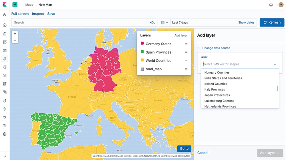
すぐに使えて便利
Elastic Maps Serviceで、レイヤーやベクターシェイプ、ベースマップを簡単に使いはじめることができます。データはあっという間に地図上の細かなベクターシェイプとなり、気になるエリアを18段階のズーム機能により、ストリートレベルにまで拡大して見ることができます。カスタマイズオプションも豊富。カスタムレイヤーから動的なクライアントサイドスタイリングまで、Elasticのマップアプリを最大活用できます。
機械学習
地理データに潜む異常を発見しましょう。位置情報により不整合を見つけ、問題を深く探ることで、根本原因を特定できます。
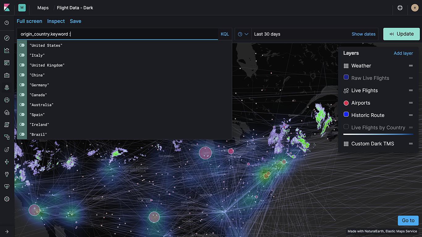
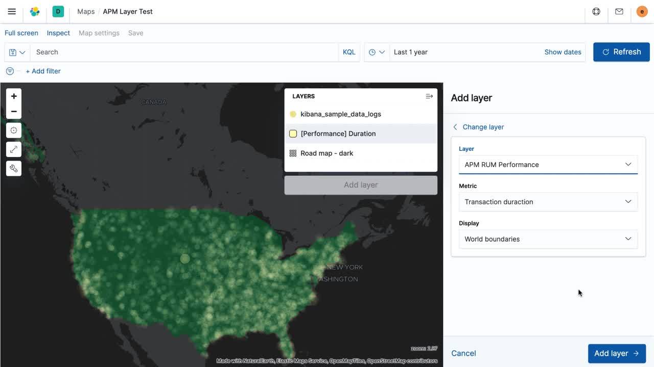
ユースケースに最適な内蔵レイヤー
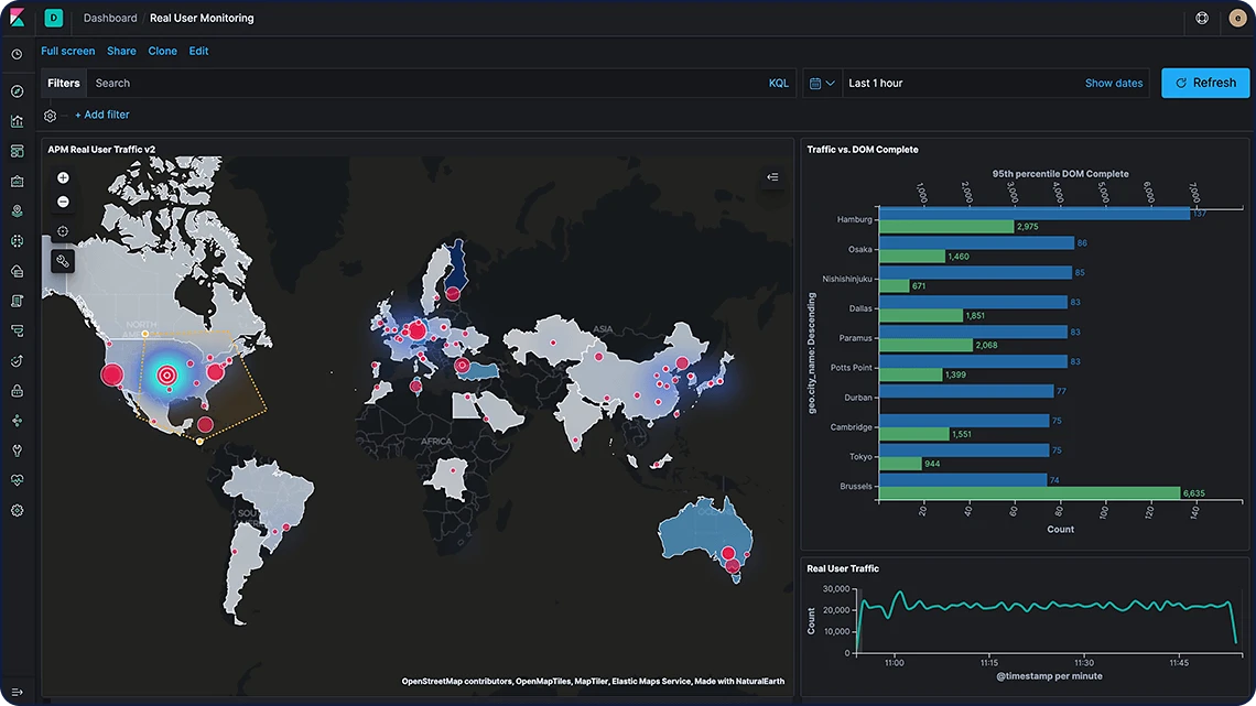
ネイティブに使えるソリューションベースの各種レイヤーを搭載するElasticマップなら、わずかな時間で高度な地理分析を構築できます。APMのユースケースでリアルユーザー監視(RUM)を実行する場合も、セキュリティシナリオに関連してネットワークトラフィックを分析する場合も、Elasticマップの設定不要のオプションがニーズに応えます。
ユースケースに最適な内蔵レイヤー
Uberの乗車マッチングサービス
移動サービスプラットフォームを運営するUberは、Elastic Stackで毎秒1,000回以上のクエリを処理し、複数のユースケースに活用しています。

地理データは、データレイヤーの1要素
メトリックも、プロキシやファイアウォールのログも、膨大なテキストドキュメントも、ログと共にElastic Stackで扱いましょう。分析の幅が広がり、運用コストが低下するうえ、アーキテクチャーをシンプルに保つことができます。