Elastic Maps
以免费且开放的方式探索
位置数据
使用 Elastic Maps 分析您的地理空间数据。对多个索引进行可视化并将其作为单一视图中的特有图层,方便您查询并关联自己 Elasticsearch 中的全部数据。
将地理空间数据添加到地图中
对 Elastic Stack 的很多用户而言,“哪里”是一个至关重要的问题。无论您希望保护自己的网络免受攻击,还是调查为何特定位置的应用程序响应时间长,或者只是打个网约车回家,地理数据和搜索都发挥着重要的作用。借助 Kibana 中免费且开放的 Maps 应用,您可以通过直观方式将地理空间图层与时态、结构化、文本和其他 Elasticsearch 数据结合起来,这样您便可以提问(并解答)具有实际意义的问题。
大自然保护协会监测全球各地办公室和边远站点(网络连接不佳)的网络安全。
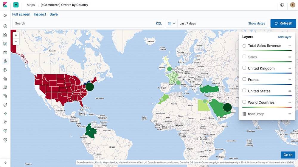
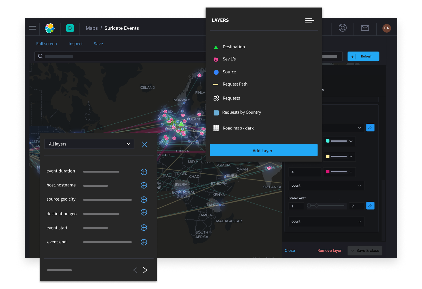
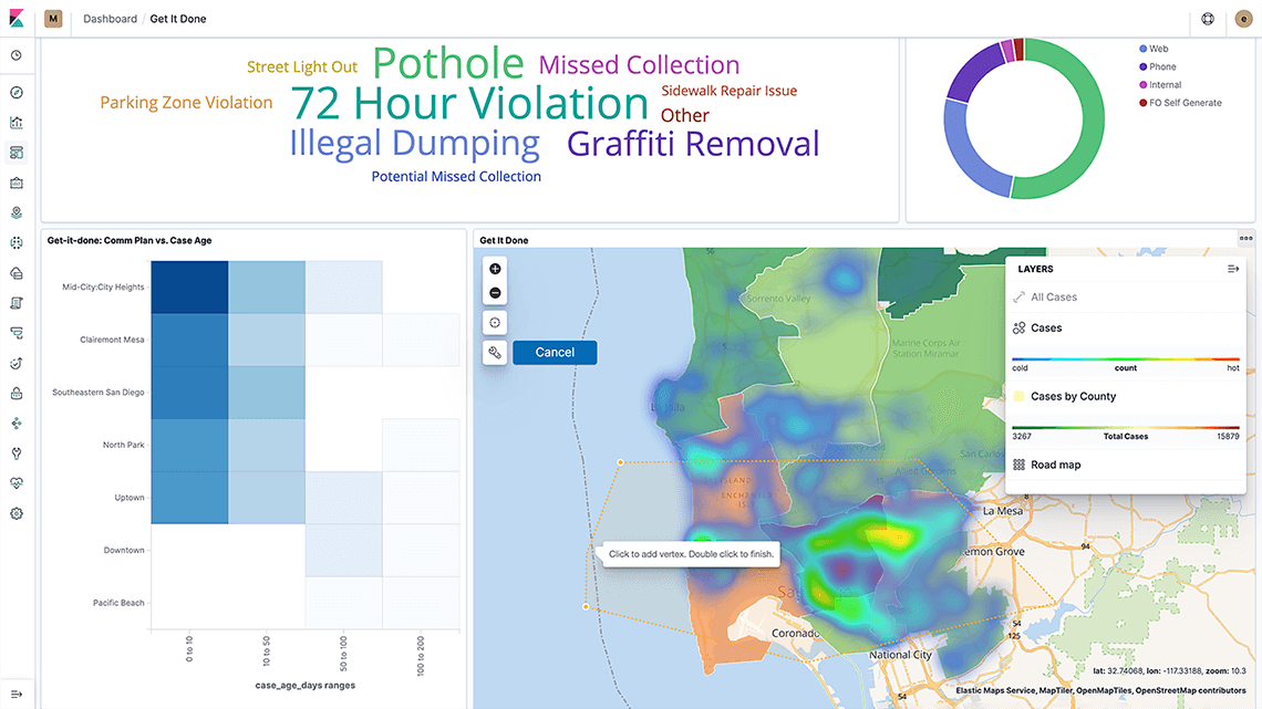
多个来源,一张地图
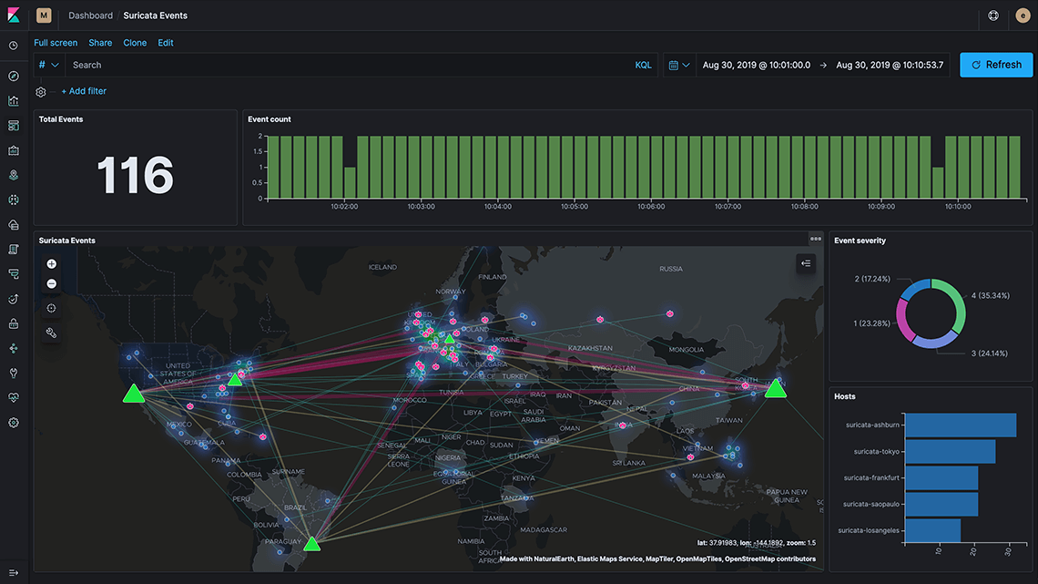
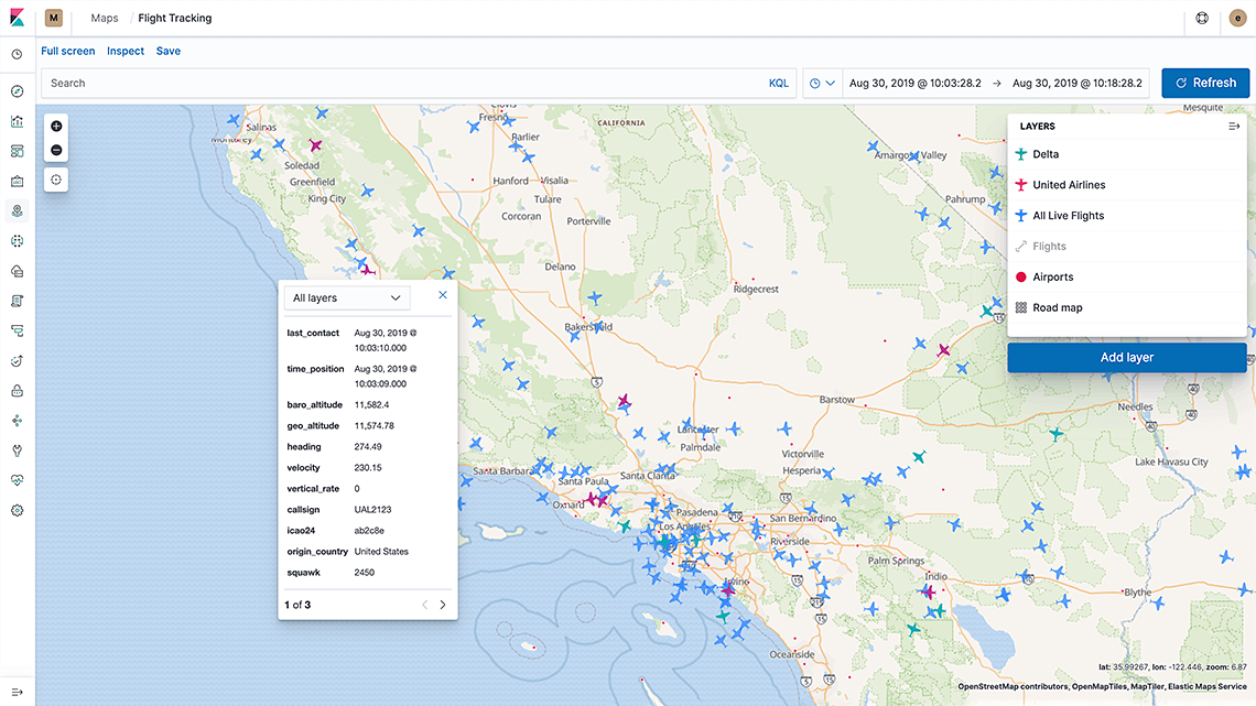
在 Kibana 内使用地图应用将来自多个索引的图层放入单一视图中。由于这些来自各个索引的图层均位于同一张地图上,您可以实时对全部图层进行搜索和筛选。在您的 SOC(安全运营中心)内,通过同一视图即可同时监测静态服务器位置以及动态攻击位置。当发现值得注意的事情时,可以逐级放大并在更细粒度层面(例如地图上的单个文档)进行钻取。
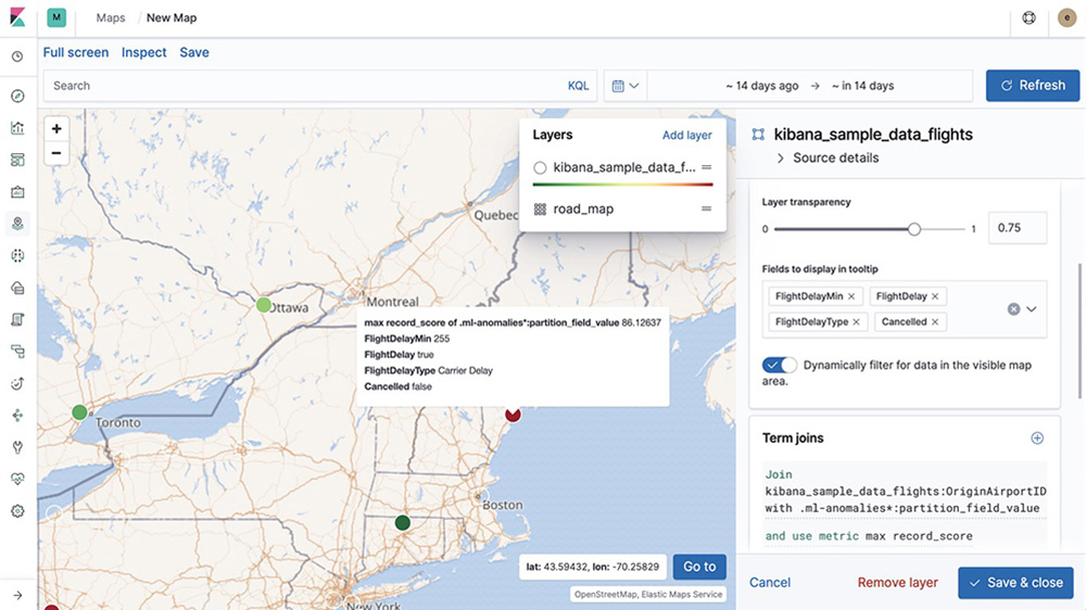
不局限于地理数据
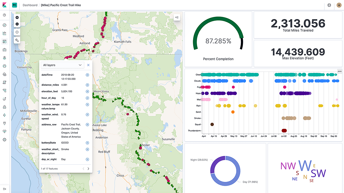
地理数据不仅局限于经纬度。地图上的每个图钉可能会包含指标、时间戳以及更多元数据。Elasticsearch 是一个很好的存储库,适用于所有类型的位置数据,从地理地点,到诸如多边形、圆形、线段、多线段以及方框等地理形状,均不在话下。而且,作为适用于所有数值型数据类型的一款全文本搜索引擎、一个列式存储和一个指标存储,Elasticsearch 还可以满足您地理空间分析之外的分析需求。
无界限分析,快速获知答案
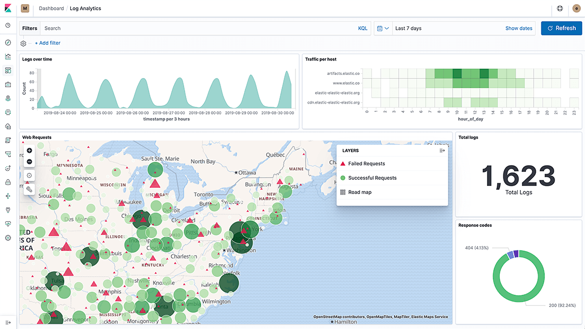
Elastic Stack 将速度与规模、相关性以及动态可视化整合在一起,为您在分析地理数据时提供强大的分析选项。 将地图嵌入到您的 Kibana 仪表板中,与您的位置数据以及所有其他数据进行交互。在单一仪表板中即可将地理查询(例如按距离排序,以及按边界形状筛选)与其他数值/文本查询结合在一起.
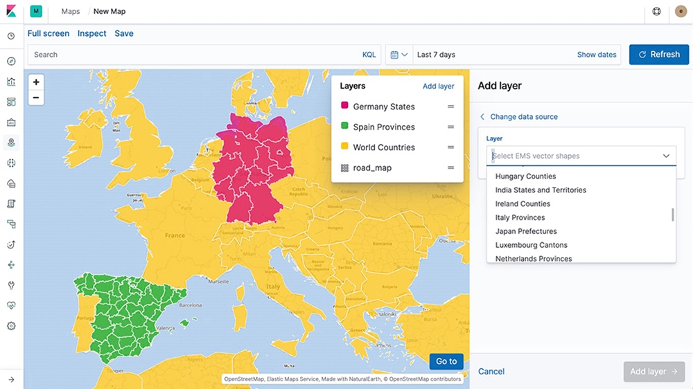
开箱即用型地图
从 Elastic Maps Service 提供的图层、矢量形状以及基础地图 (basemap) 开始着手。使用详尽的矢量形状,实时观看您的数据在地图上渐具雏形,然后借助 18 个缩放层级找到您感兴趣的区域,最细可到街道层面。希望拥有更多选项?使用 Elastic Maps 应用,您可以创建定制图层,使用动态的客户端样式,以及完成更多操作。
Machine Learning
查找地理数据中的异常。按位置查找不一致之处,深入发掘问题,并找出根本原因。
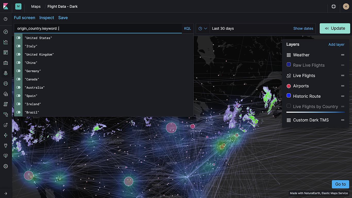
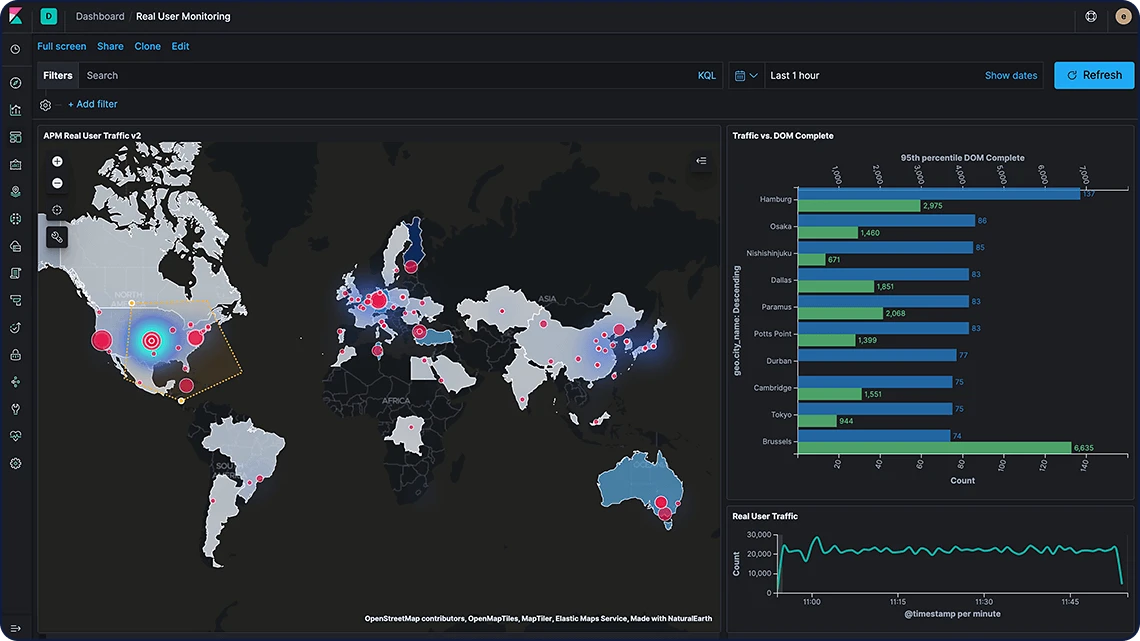
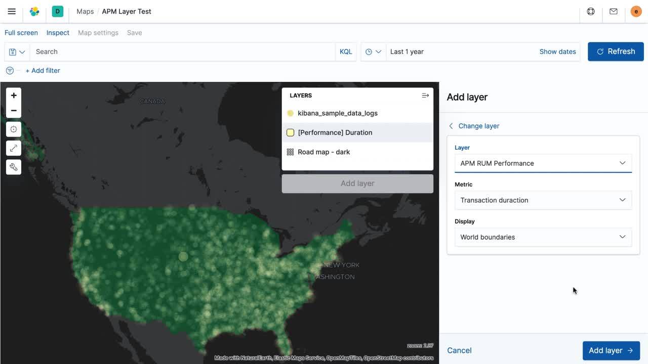
使用内置图层来满足自身用例的需求
Elastic Maps 能够以原生方式提供基于解决方案的图层,助您瞬间构建出色的地理分析。从 APM 用例的真实用户监测 (RUM) 到安全场景的网络流量,Elastic Maps 提供开箱即用的选项来支持您的需求。
使用内置图层来满足自身用例的需求
使用优步叫车
了解优步如何使用 Elastic 每秒处理 1,000 多次查询,为这家运输公司的多个用例提供支持。

地理数据轻松变身为您数据中的一个图层
有指标吗?代理或防火墙日志?抑或是包含大量文本的文档?将所有这些集中进 Elastic Stack,进而充实分析,降低运营成本并简化架构。